Day Twenty-two
Napa to China Camp State Park, 60 miles
Today promised to be a straight forward ride of about 60 miles. Temperatures have moderated in the inland valleys and I am heading towards San Francisco Bay, where temperatures are cooler still. Hill climbs are short—no mountains, just gentle ups and downs. Most of today’s route is on dedicated bike paths.
North of Napa is agricultural land and the town itself is mostly neighborhoods of single family homes. South of town is where the industry is.

The scope of the wine industry
Whole industrial parks of massive tilt-up concrete warehouses, tastefully landscaped, of course, but truly scaled for a high volume business. As I passed the airport I also passed waste handling, the recycling plants, compost yards and the transfer station. Napa County makes a lot of garbage.
As I rode south into the communities of the Bay Area proper, traffic management changed. Up the valley, I had the feeling that the bike paths were there to let cyclists slow down and enjoy themselves out of traffic. South of the dump, bike paths seemed to be tasked with keeping bikes off the roads so the sheer volume of cars and trucks could move unimpeded. This is about keeping bikes out of the way so cars can zoom. I felt as a rider that my experience was being channeled and curated, by careful planning, to keep me out of the way of the real business at hand, the safe and efficient management of massive quantities of motorized traffic.


Still, I have to say that having bike paths lowers the cognitive load of the cyclist as well. I was a more relaxed rider today than on any day of the trip so far. It’s easier riding, mentally, when there are fewer potential menaces to pay attention to.
Tempted
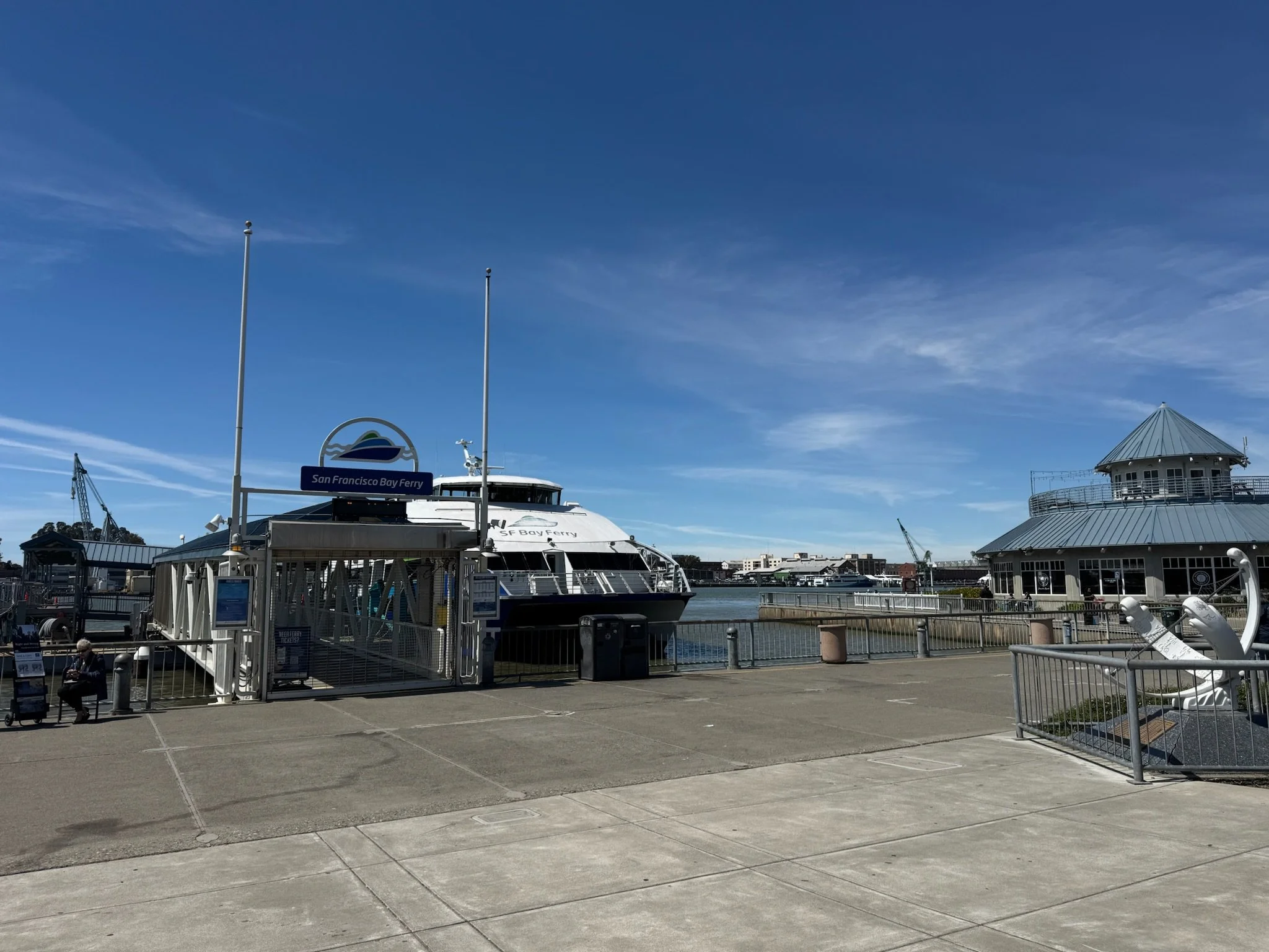
I was tempted to just ride the ferry across the bay…but this is a bike ride, not a ferry ride.
The Wine Trail bikeways were soon replaced with the Bay Trail bikeways. I crossed the first of three bay bridges of my ride, the Zampa/I-80 bridge over Carquinez Strait, which has a well-maintained separate bike/pedestrian path. The only community with lousy bikeways is North Richmond. While the designation of bikeway is present, the roads are shot, with bad pavement and faded road markings. In Richmond I maneuvered around more broken glass than on the entire ride so far. You can tell something about a place when people throw glass in the street, and the city doesn’t clean it up.
The Northeast Bay is peppered with smaller cities of neat neighborhoods, among massive industrial complexes, especially oil storage and refining. Half of California runs on fuels refined here. Riding through this area required careful map reading, as the bikeways would turn or end suddenly. I did some backtracking when the path just ended, and I realized I missed a turn on the map. 45 miles into the day, I reached the east end of the impressive and long I-580 bridge, linking the NE Bay communities with Marin County to the west, across San Pablo Bay. Again, excellent cycling infrastructure, especially across the bridges, made for a stress free ride into Marin.


Once across the I-580 bridge, I was on the final pitch of the day’s ride. Dinner. Today’s food so far was a breakfast sandwich and three street tacos. Should I stop at a restaurant, stop at a grocery store, or just eat whatever is on my bike? I opt to dig through my panniers and eat whatever I already have. So dinner was a recovery drink, left over crackers, a chicken salad and crackers snack, and a cup of hot cocoa. This was all enjoyed after I found and made camp at China Camp State Park, just north of San Rafael, on the west shore of San Pablo Bay. With a 50-cent hot shower, I was cleaned up and ready for bed. Its September and the sun is setting much earlier now. Except for a middle school group in the group camp, the campground is empty. This contrasts amazingly with the packed campgrounds just a week ago, before the Labor Day Weekend. Kids are all back in school now, and working American is back at the salt mine. The countryside is once again nearly empty.
Tomorrow I’ll have my instant coffee in camp, then pack up and get some miles down before breakfast, which is now a daily habit. 19 miles down the road I will cross the Golden Gate into San Francisco, and continue down the west shoreline of the bay towards Palo Alto. I plan to take my time through San Francisco. With today’s ride so flat, I may even charge a few of the city’s famous hills, just for the fun of it.
