
Day Nineteen
Royal Tree Villas in Leggett to Ukiah, 63 miles.
Up and out early this morning. I didn’t see Johnson, as he said I wouldn’t. He pulls the to-midnight shift and isn’t up at dawn. Johnson is an Americanized version of his name in Chinese, which he never shared. But the Villas has very much an East-West fusion to it. The branding on the instant coffee and little chocolates in the room was in Chinese. The decor had a definite Mainland Asia sensibility to it. Learning how a guy like Johnson ended up running a motel in a hamlet in the Redwoods is a big reason why I want to come back to stay here longer.
Leggett has enough coastal influence to keep temperatures cool. It was a brisk 54 degrees out—a nice way to start a day that was to turn out to be a scorcher. Just 3 miles from the Villa, the road left the S. Fork of the Eel River proper and started up a tributary, Rattlesnake Creek.
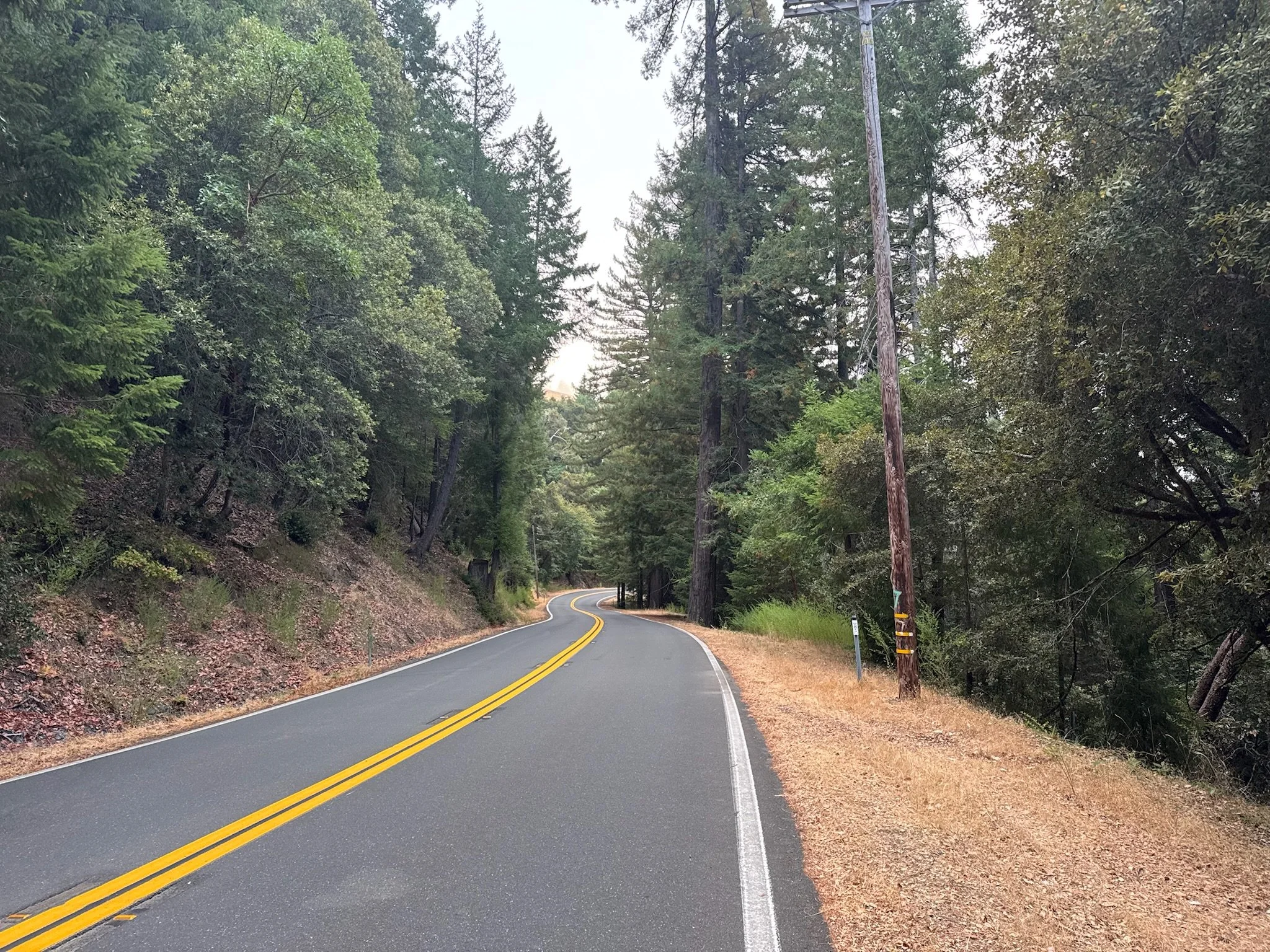
The road was not up or down for a stretch
This may be the only flat stretch I see for 50 miles, so I took a picture of it.
Sure enough, the road began to climb to a road cut called “Rattlesnake Gap”, at about 15 miles into the ride, then descended into the valley of Tenmile Creek. [Editor’s note: that is the actual spelling of the creek’s name.] Tenmile Creek runs towards the south fork of the Eel River, which drains into the Pacific. The northwest part of the town of Laytonville is in the headwaters of of Tenmile Creek.
Laytonville is in a level area maybe 10 miles long called Long Valley. I had a big breakfast at the 101 BBQ & Grill at about mile 21. The southeast part of Long Valley seems to drain into Long Valley Creek. It looks like Long Valley Creek flows into the Eel River, not the South Fork of the Eel River, like Tenmile Creek does.
This landscape is very confusing. What I do know as a cyclist is that the highway follows any one creek for only so long before climbing over a ridgeline and down into another creek’s valley. Over and over again. Laytonville and the Long Valley may be at the height of this area but the love keeps coming as I ride south and west. Hills after hills.

Leaving the redwoods
The biggest change at Laytonville is the climate. In just a few short miles I have pedaled out of the Redwood forest, which requires lots of moisture from the sea, to the more open grassland and oak tree stands that require plenty of dry. Even on a bike this transition is startlingly rapid. If feels like I am in an entirely different California from where I started just a few miles ago this morning.
There’s a fair amount of road repaving on 101. I am making a good pace down a gentle slope on fresh asphalt and BAM! I’m on the ground hard. “Share the Road” signs, with a pictogram of a bicycle are a regular sight here. Usually they are on posts.

I hit a temporary Share the Road sign on a heavy springed base, placed right on the shoulder where I ride. I was just tooling along, not looking far enough ahead. Smackdown! Of course, the first thing I did was spring up and look around to see if anybody saw. Not a car in sight. This was really dumb. No torn fabrics of blood leaking out. The bike handled it like a tank. I’ll have a sore left shoulder and chest for a few days, but nothing felt broken and I can breathe alright. Reminder: look ahead.
I reach Willits and the temperature has climbed into the 80s. There’s another hard, long climb out of the south end of Willits, in the heat and then—Hurray!—a sign warning trucks of a 6% down grade for FIVE MILES! In addition to the ups and downs, I have climbed enough net elevation since Fortuna to get over the Coast Range to earn back five miles of 22 mph without pedaling.
Approaching the outskirts of Ukiah, the temperature is now in the mid 90s and still climbing. After the coast cool, this heat just drains my energy. I limp into today’s destination, the Ukiah Enterprise car rental agency. It’s time for another adventure inside of this cycling adventure.
The ride is now on pause again for a few days
I’ve rented a car and am driving 600 miles back north to Cascade Locks on the Columbia River, for my niece’s wedding..
Today is a Thursday. I’ll be back on the bike next Tuesday afternoon to pedal to the Bay Area, probably a 3 day ride from Ukiah. I haven’t yet settled on an exact route south. It will be between 700-850 miles. The coast will be farther but cooler. If this heat sticks around into late September, I definitely will limit my time inland. I might pause again in Alameda or San Francisco and fly home to help more with our move-in in Missoula. This ride will continue to be planned around other big life events. Also, weather and climate will play a large part in the decision to bang the rest of the trip out in early September, or hold off a few weeks and finish in late September/early October.
Through Washington, Oregon and Northern California, I have now pedaled 1,000 miles. I just added my riding days up—exactly 1,000 miles. It’s been a major test of fitness and gear, and also a challenge to fit a clear adventure objective into the ambiguous and shifting needs of a home and work life in major transition. Can this be done, and should it? I am modeling and testing the skills, methods and mindsets we teach at the Center for Adventure Leadership. I noted a year ago on my Southern Tier trip that if our approach to adventure is sound, I will succeed and if they are not, I will fail. Publicly. I’m pretty good at this stuff, but that doesn’t make success automatic. I still has to show up everyday and do the work. Getting smacked down today by a Share the Road sign is a visceral, painful reminder that novices and experts alike are equally subject to the unapologetic forces of reality.
